Nazca lines are one of the biggest unexplained archeological mysteries. The archeological site consists of geoglyphs and lines. About 2,000 years ago, there was a culture called Nazca living in this area. They made more than 70 designs of plants, insects, and animals, 800 straight lines, and 300 geometric figures. But why the geoglyphs and lines were made is still a mystery. They lie in an area of over 500 km2 (310 sq mi) from the Pacific Ocean to the Andean mountains. The most famous geoglyphs are a monkey, a 180 m (590 feet) long lizard, a condor, a hummingbird, a spider, and recently a cat.
Why were they made?
There are several theories on why the ancestors decided to draw these lines and geoglyphs. Here are some of the most likely:
- For agricultural purposes as an astronomical calendar – since the area is really dry and it practically sits on the desert, the water was super important for these cultures. And that could’ve been one of the biggest reasons they made the lines, to be able to predict the weather.
- For religious purposes – the geoglyphs were most likely built as offerings to the gods which was really common in those times for many cultures.
There are some other theories that say the Nazca culture was communicating with aliens, but we actually don’t have any evidence that would prove this theory.
How were they created?
The lines were made by a really simple process of removing the dark volcanic stones from the bright powdery soil. To make a perfect line the Nazcas used a long rope and wooden stakes. There are other crazy theories, for example, the aliens built the lines, or the Nazca people were able to build a hot-air balloon.
How were they discovered?
In the 1920s, the pilots flying over this area spotted the lines for the first time. There are some theories by many archeologists, but just one of them spent the longest time investigating the lines, Maria Reiche.
This name is strongly connected with Nazca and everyone in the region knows her name very well. Maria Reiche was a German archeologist and mathematician that lived for around 45 years in Peru. She dedicated the last years of her life to the intensive research of Nazca lines. Even at her high age, she worked in the desert during the extreme weather of high temperatures and cold nights.
There is a small museum showing all her work and even the airport and the main square were named after her. She was also teaching at a Peruvian university and people respect her even these days.
How could the lines and geoglyphs be so well preserved?
Even after over 2,000 years, many lines were still visible when they have discovered them. Probably in any other place, it would have been way harder to spot them. Archeologists could discover many of them thanks to the combination of these factors:
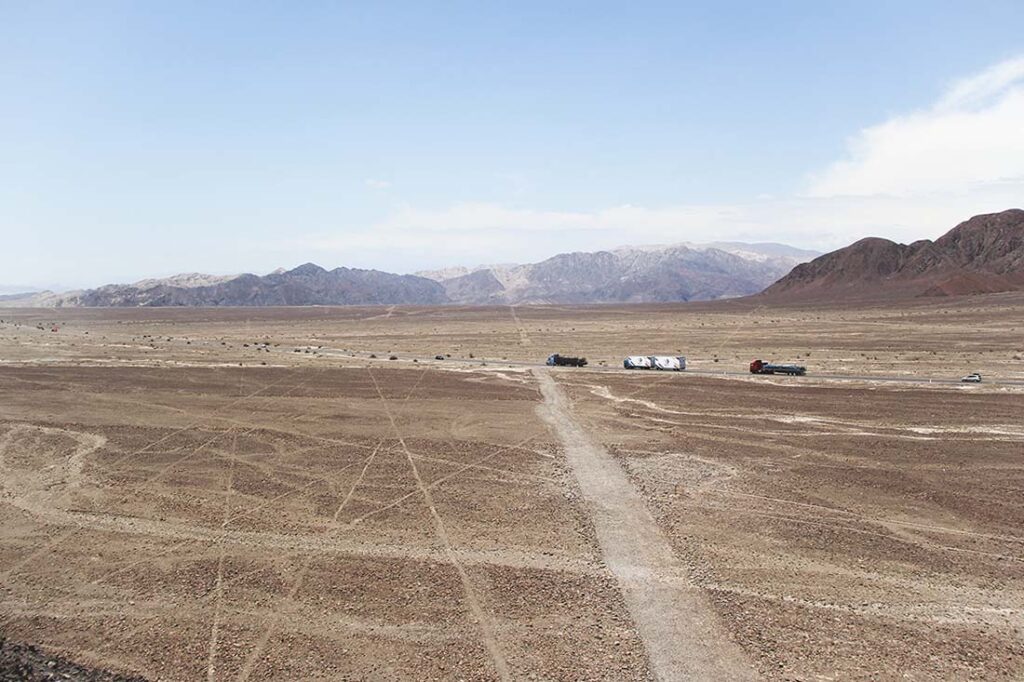
- The location – The lines and geoglyphs sit on the Peruvian desert which is sparsely populated. In most cases, urbanization destroys the archeological sites, but here it’s “just” a narrow Panamericana Sur crossing the lines and one geoglyph.
- Material – So you would wonder, if the Nazcas made the lines in the desert, how could they still be visible after all that time even though no one has touched them? Well, the ancient cultures knew really well where to build them. As I wrote above, the surface consists of two layers – bright soil and darker stones. Thanks to that, we can still see the lines and geoglyphs even though the bright soil was already a bit covered by dirt. When the stones absorb the heat the cushion of hot air also protects them from the wind. The lower layer contains plaster which creates a protective layer.
- No rain – This is actually related to the location. The region has been suffering from the lack of water for thousands of years which have also helped to preserve the lines and geoglyphs.
How to get there and see them?
Nazca town is located 450 km from Lima to the south. There are buses that go from Lima directly to Nazca, but the best thing you can do is rent a car. Because we are in Peru, there are also one-day tours from Lima starting from $300 per person. But if you are already in Nazca town, from there you have some options.
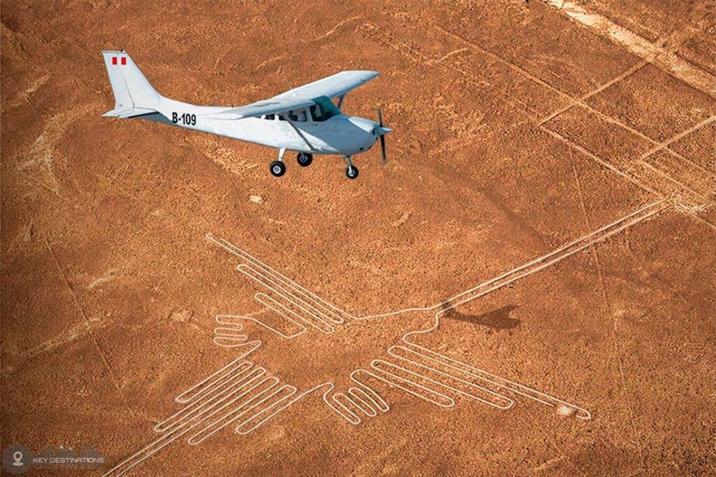
- Flying over
The most popular and best way to see the lines and geoglyphs is to fly over. You can have a 35-minute flight starting at $85 where you will see 12 of the most famous Nazca Lines. Then you have around a 55-minute flight over 12 Nazca Lines and newly-discovered Palpa lines. Or, you don’t even have to go to Nazca, you can fly from Ica or Paracas to see the Nazca lines which will take around an hour. Also, be ready to pay the airport tax ($10) apart from the price you pay for the flight.
2. From the viewpoints
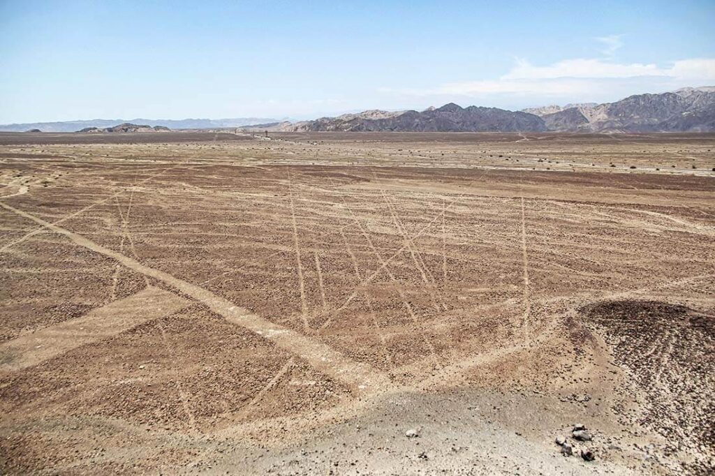
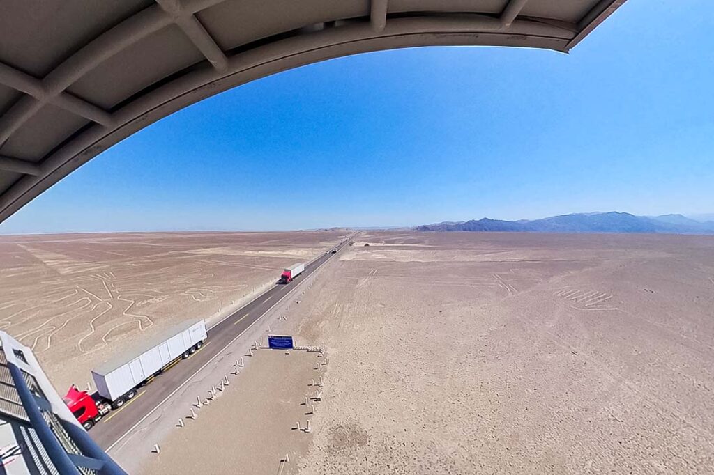
Before you reach the Nazca town arriving from Palpa you will find yourself on a long straight road with a sign saying “Nazca lines”. On the side of the road, there is a new observation tower, the entrance is S/4 ($1) and from this tower, you will see just three figures: the lizard, tree, and hands.
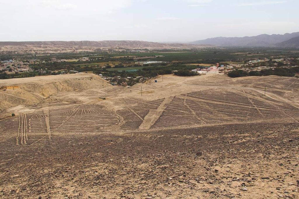
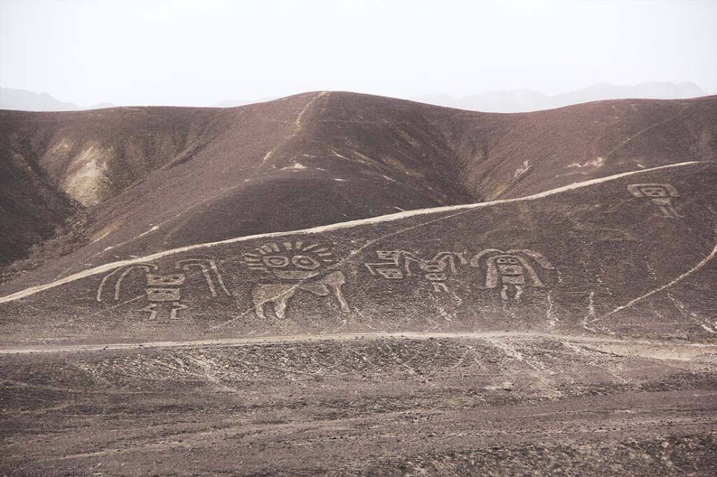
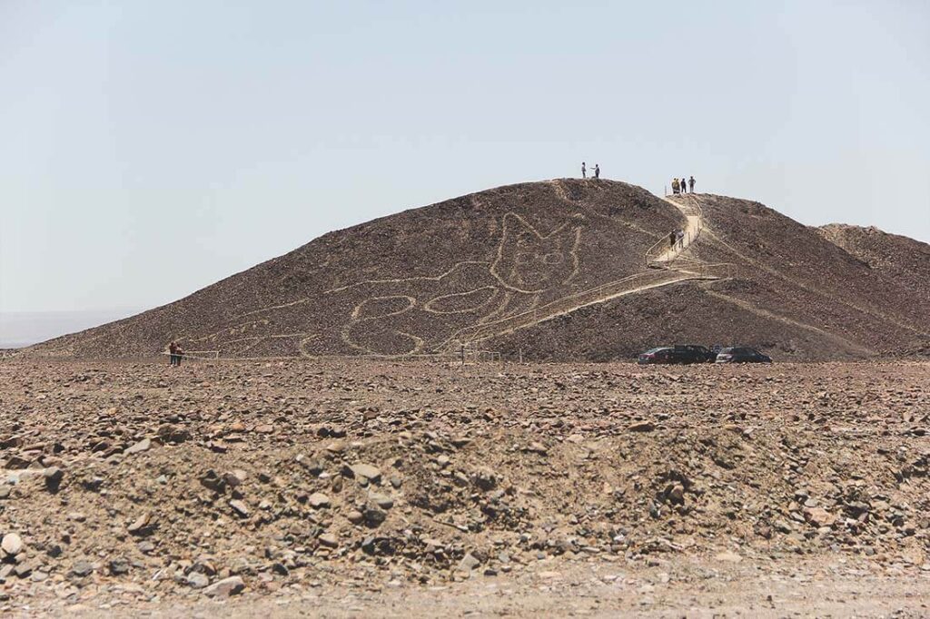
Just about 1 km is a small hill, called Mirador Natural, with a view of the lines. This viewpoint became even more interesting when a huge geoglyph of a cat was found last year. You can see this cat from the main road, but also take a close look, it sits right on a side of the hill. The best thing you can do is to turn right from the main road and park directly in front of the hill on which they found the cat. You can then walk up from where you have a better view of the lines.
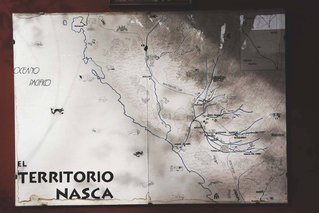
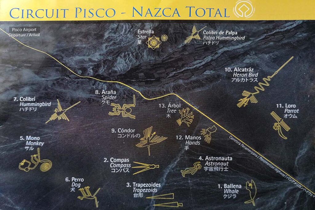
When you’ve already gotten this far, here is a map I created with all the locations where you can see geoglyphs and lines and how to get there. I also added some other pretty interesting places around Nazca you just must see.